Description
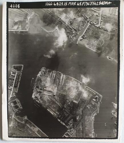
Aerial photo Schiedam (Rotterdam harbor – Wilhelminahaven) 15 March 1945.
The photo shows Wiltonhaven, Wilhelminahaven and the Nieuwe Maas.
Size: 20 x 23 cm
The photo was made by 542 Sqn., they flew with Supermarine Spitfires.
No. 542 Squadron RAF was a Royal Air Force Squadron formed as a photographic reconnaissance squadron in World War II.
During the Second World War, Wilton-Fijenoord built several submarines for the German Kriegsmarine. During that time, the yard expanded its workforce from 4,000 to 6,500 people, while other yards in Rotterdam and Schiedam reduced their activities. After the war, the Wilton management was imprisoned for their extensive collaboration.
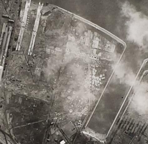
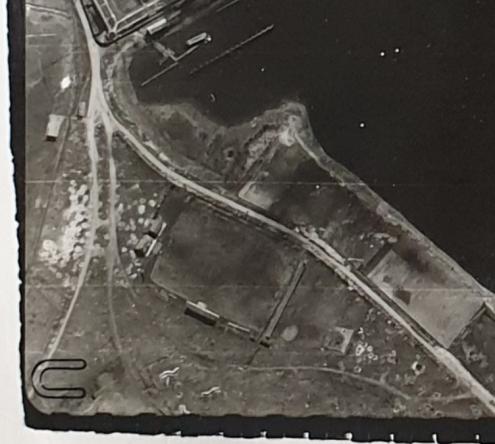
Image no 2 and 3 clearly shows hits from Allied bombings.
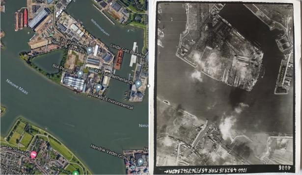
Image no 4.
Aerial photo 1945 along with the situation in google maps in 2020
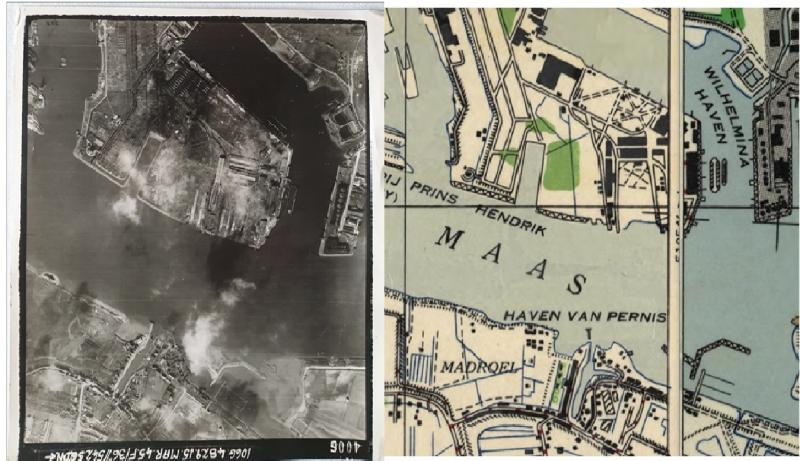
Image no.5.
Aerial photo 1945 along with the Map of Vlaarsingen and Rotterdam 1: 25000 1st edition 1944 (Army Map Service. U.S. Army. Washington. D.C. 130087 1944.
__________________________________
De foto toont Wiltonhaven, Wilhelminahaven en de Nieuwe Maas.
Maat: 20 x 23 cm
De foto is gemaakt door 542 Sqn., Ze vlogen met Supermarine Spitfires.
542 Squadron RAF was een Royal Air Force Squadron gevormd als een fotografisch verkenningssquadron in de Tweede Wereldoorlog.
Tijdens de Tweede Wereldoorlog bouwde Wilton-Fijenoord diverse onderzeeboten voor de Duitse Kriegsmarine. In die tijd breidde de werf het personeelsbestand uit van 4.000 tot 6.500 man, terwijl andere werven in Rotterdam en Schiedam hun activiteiten inkrompen. Na de oorlog werd de Wilton-directie gevangengezet vanwege hun vergaande collaboratie.
Op afbeelding 2 en 3 zijn duidelijk treffers van geallieerde bombardementen te zien.
Afbeelding nr.4. Luchtfoto 1945 samen met de situatie in google maps in 2020
Afbeelding nr.5.
Luchtfoto 1945 samen met de kaart van Vlaardingen en Rotterdam 1: 25000 1e editie 1944 (Army Map Service. U.S. Army. Washington. D.C. 130087 1944.
